Department of Conservation and Recreation Department of Conservation and Recreation
Conserve. Protect. Enjoy.
DCR Logo
Mobile Menu
Search DCR Site
Facebook Twitter YouTube Instagram LinkedIn
About DCR
 
State Parks
 
Natural
Heritage
Soil and Water
Conservation
Recreation
Planning
Dam Safety and
Floodplains
Land
Conservation
  • Natural Heritage
  • About Natural Heritage
    • Overview, Mission
    • Natural Heritage Inventory
    • Community Ecology Program
    • Healthy Waters Program
    • Information Management
    • Environmental Review
    • Natural Area Protection
    • Stewardship
    • Staff
    • Internships
  • Natural Area Preserves
    • Public Access Guide (PDF)
    • Special Events and Hunting
    • Natural Area Research
  • Rare Species and Natural Communities
    • Rare Species and Natural Community Search
    • Rare Species and Natural Community Lists
    • Natural Communities of Virginia
    • Locality Summary Maps
    • Rare Butterfly and Dragonfly Atlas
  • Information Services
    • Info Services Order Form
    • Locality Assistance Program
    • NH Data Explorer
    • Species and Community Search
    • ConservationVision and Green Infrastructure
    • Telecommunication Towers (PDF)
    • Conservation Lands Database
    • Wetlands Catalog
    • Species Habitat Modeling
  • Pollinator Smart Solar Site Portal
    • Comprehensive Manual (PDF)
    • Scorecard Templates
    • Virginia Native Plant Finder
  • Native Plants
    • Benefits
    • Natives vs. Aliens
    • Buying and Growing
    • Virginia's Physiographic Provinces
    • Native Plant Finder
    • Flora of Virginia
    • Policy 151 - Plantings on Department Lands
  • Invasive Plants
    • Invasive Plant List
    • What You Can Do
    • Factsheets
    • Invasive Species Working Group
  • Invertebrates
    • Monarch butterflies
  • Caves/Karst
    • Cave Board
    • Cave and Karst Trail
  • Publications
    • Flora of Virginia
    • Peer Reviewed Papers
    • Enews
    • Brochures and Factsheets
    • NH Plan
Home » Natural Heritage » Locality Liaison Program

Locality Assistance Program for Natural Heritage Conservation

Program Mission & Goals

SPECIES HIGHLIGHT
photo of Seepage bog community
Coastal Plain-Outer Piedmont Seepage Bog

click image to read more

Through the Locality Assistance Program for Natural Heritage Conservation, the Virginia Department of Conservation and Recreation's Division of Natural Heritage (DCR-DNH) assists local conservation partners in fully utilizing natural heritage resource information as well as consultative services to ensure protection of natural heritage resources (rare, threatened and endangered species, significant natural communities, caves and karst features).

The Locality Assistance Program seeks to establish natural heritage resource information as part of fundamental locality decision-making criteria through tools such as:

  • Project Review
  • Project Siting
  • Comprehensive planning
  • Zoning amendments
  • Open space and green infrastructure planning
  • Purchase and transfer of development rights (PDR/TDR) programs

Locality Liaison

The DCR Locality Assistance Program for Natural Heritage Conservation is implemented by the locality liaison who serves as a primary DCR-DNH point of contact for:

  • Local governments
  • Planning district commissions
  • Land trusts
  • Other conservation partners including Virginia Indian Tribes

The locality liaison is available to provide presentations on the Locality Assistance Program and the Natural Heritage Data Explorer to interested localities and other conservation partners. The locality liaison can also provide basic information on ConserveVirginia and Virginia ConservationVision. Each presentation is tailored to the specific organization and is followed by a discussion of the organization's needs.

Please contact your Locality Liaison for additional information or to schedule a presentation for your locality or organization.

Tyler Meader, Locality Liaison
Virginia Department of Conservation and Recreation
Division of Natural Heritage
600 East Main Street; 24th Floor
Richmond, VA 23219
Tyler.Meader@dcr.virginia.gov
(804) 225-2429
photo of tiger beetlet
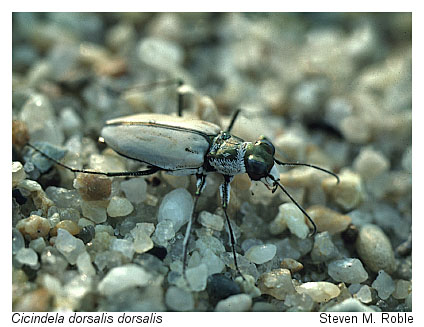
© DCR-DNH, Steve Roble; Northeastern beach tiger beetle (Cicindela dorsalis dorsalis)
photo of tiger beetle habitat
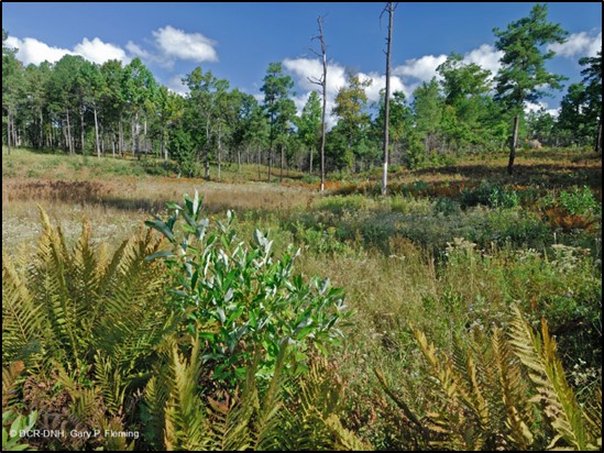
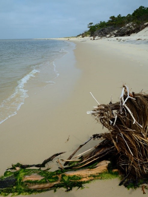
© DCR-DNH, Steve Roble; tiger beetle habitat

Tools and Services

The Locality Assistance Program offers a suite of optional tools and services to localities and other local conservation partners. The locality liaison can provide assistance in selecting from the various options in order to tailor the program to local needs.

photo of field zoologist inventorying for rare species 
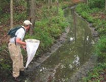
NH field zoologist inventorying for rare species.

A full list of the tools and services available in the DCR Locality Assistance Program for Natural Heritage Conservation are listed below.

Tools

  • Natural Heritage Data Explorer - Online interactive data mapping tool
  • ConserveVirginia - A map of Virginia's highest conservation value lands
  • Virginia Wetlands Catalog - An inventory of wetlands and potential wetlands prioritized for conservation and restoration purposes by parcel, subwatershed, and wetland boundaries.
  • Virginia ConservationVision - A digital atlas for green infrastructure planning
  • Inventory of Natural Heritage Resources (fee charged)

Services

  • Initial meeting with DCR-NH staff to include power point presentation outlining DCR-NH program, with detailed information about inventory (highlighting species documented or likely to occur in locality), data management and environmental review process
  • Training to provide explanations of Natural Heritage data and available Natural Heritage tools
  • Provide Natural Heritage Resource data in GIS form (shapefile) or access to the Natural Heritage Data Explorer
  • Review proposed development projects to avoid and minimize impacts to natural heritage resources
  • Recommend language for the locality's comprehensive plan and other key planning documents, such as PDR and TDR programs, overlay districts, etc.

Locality Data Subscriptions

image of locality map 
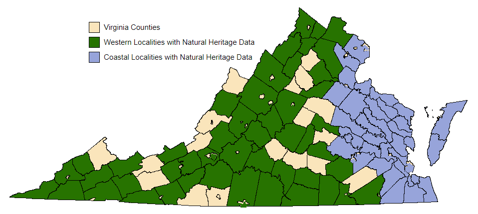
Many localities and conservation partners throughout Virginia have Natural Heritage Resource Data Subscriptions. Click the map(last updated 11/6/2023) to see localities in your area that have natural heritage resource data to use in decision-making.

The subscription provides users with data concerning natural heritage resources. Data are available in the form of a shapefile to integrate into an existing GIS, or by access to the Natural Heritage Data Explorer. Subscriptions are free to local governments, Virginia Indian Tribes and other non-profit organizations. A data license agreement is required. Subscriptions last one year, and quarterly updates are provided.

Information Services Order Form

Once you've determined which services you need:
  • Fill out the online Information Services Order Form (updated 2025)
  • If you experience difficulty with the online form, please print, fill out and send this PDF version
logo  
logo

This project was funded in part by the Virginia Coastal Program at the Department of Environmental Quality through Grant NA18NOS419 task #5 of the National Oceanic and Atmospheric Administration, Office of Ocean and Coastal Resource Management, under the Coastal Zone Management Act of 1972, as amended.

Virginia Department of Conservation and Recreation
600 East Main Street, 24th floor | Richmond, VA 23219-2094 | 804-786-6124
Please send website comments to web@dcr.virginia.gov
Address general inquiries to pcmo@dcr.virginia.gov
Copyright © 2025, All Rights Reserved
Last Modified: Wednesday, 28 May 2025, 02:39:20 PM
eVA Transparency Reports View the Virginia Department of Conservation and Recreation's expenditures.
Contact Us | Media Center | Privacy Policy | ADA Notice | FOIA | Jobs | Code of Ethics (PDF)
DCR Organizational Chart (PDF) | Strategic Plan (PDF) | Executive Progress Report (PDF) | Public Safety & Law Enforcement