Department of Conservation and Recreation Department of Conservation and Recreation
Conserve. Protect. Enjoy.
DCR Logo
Mobile Menu
Search DCR Site
Facebook Twitter YouTube Instagram LinkedIn
About DCR
 
State Parks
 
Natural
Heritage
Soil and Water
Conservation
Recreation
Planning
Dam Safety and
Floodplains
Land
Conservation
  • Soil and Water Conservation
  • Soil and Water Conservation Programs
  • Regional Offices
  • Watersheds
    • Hydrologic Unit Geography
    • Hydrologic Unit Geography Origins
    • Perennial Streams
  • Nutrient Management
    • Nutrient Management Training
      • Certification
      • Exams
      • Training Schools
      • Continuing Education
      • Presentations
    • Planner Resources
      • Planner Directory (PDF)
      • DCR Staff Contacts
      • Approved Soil Testing Labs
      • Nutrient Management Plan Writing App
      • Agriculture-Specific Information
      • Turf and Landscape-Specific Information
      • Hydrologic Unit Map
      • Newsletters
    • Direct Pay
    • Farm Animals Data Overview
    • Virginia Soil Surveys
    • NPS Assessment
    • Poultry Litter Program
    • Urban Nutrient Management
      • Lawn care operators
      • Fertilizer Calculator
      • Golf Nutrient Management Planning FAQ
      • Golf Nutrient Management Grants FAQ
    • VA Nutrient Management Standards and Criteria
    • Nutrient Management Training and Certification Regulations
    • VA Phosphorus Index
  • Agricultural Incentives
    • Nonpoint Source Pollution Best Management Practices
    • Virginia Cost-Share (VACS) Program
      • Agricultural Cost-share FY25 Program Overview
      • Agricultural Best Management Practices Cost-Share Manual
    • 2022 NPS Pollution Assessment and Prioritization
    • Best Management Practices Tax Credit Program
    • Conservation Resource Enhancement Program (CREP)
    • VNRCF Match Funds
    • Database Query
  • Conservation Planning
    • Program documents
  • Resource Management Planning
    • Developer Certification
    • Resource Management Plan Program Highlights Report
    • Links and Resources
  • Soil and Water Conservation Districts
    • SWCDs by Locality
    • Clean Water Farm Awards
    • Agricultural Cost-Share Marketing Toolkit
    • Staff and Director Resources
    • Training
      • BMP Training
      • Administration & Bookkeeping
      • Director Orientation
      • Mandatory and Recommended Courses for Staff and Directors
    • Directory
  • District Engineering Services
    • DCR Standard Drawings
    • Engineering Forms
    • Agricultural BMP Presentations and Training
    • Engineering Job Approval Authority (EJAA) Guidelines
    • Federal Watershed Dam Program
    • SWCD Dam Owner Resources
    • Workgroup Meetings
  • Shoreline Erosion Advisory Services
  • Calendar, Training Sessions
  • Soil and Water Conservation Resources
  • Opportunities for Farmers of Color
  • Environmental Education
Home » Soil And Water » Perennial Streams

Perennial Streams

Perennial Stream

The Department of Conservation and Recreation Perennial Stream Viewer dataset has been created in accordance with §62.1-44.122 of the Code of Virginia to determine compliance with §62.144-123 of the Code of Virginia. The dataset adheres to all requirements established by the Virginia Soil and Water Conservation Board (Board) and the Department of Conservation and Recreation (Department) guidance document entitled Virginia Soil and Water Conservation Board Guidance Document on the Methodology for Identifying Perennial Streams. The Board and the Department reserve the right to utilize the data for other purposes as approved by the Board or Department.  

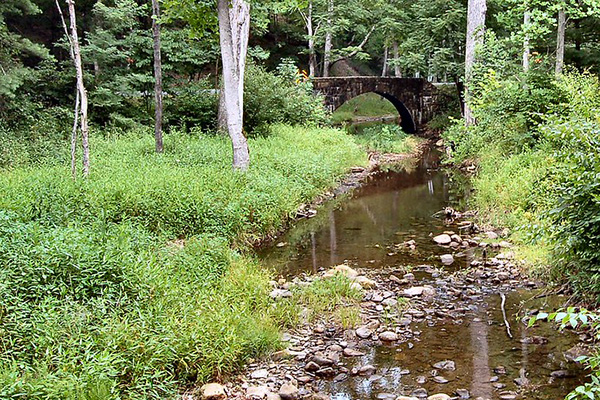
The dataset was created utilizing information from the Virginia Information Technology Agency’s (VITA) Virginia LIDAR dataset; SSURGO dataset that includes information about soils as collected by the National Cooperative Soil Survey; 2002 VGIN-created stream network (derived from digital elevation models (DEMs); and the United States Geological Survey’s National Hydrography Dataset (NHD). Based on these datasets, the dataset delineates perennial or intermittent stream segments within Virginia’s portion of the Chesapeake Bay watershed. 

Perennial Stream Viewer application

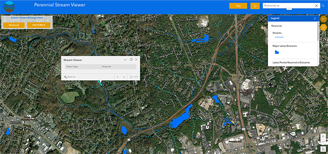
A public viewing application has been created that displays the geographic location of the streams along with a differentiation between a perennial and intermittent designation. The application also allows viewers to submit stream segments that appear to clearly deviate from the imagery which will allow DCR to make updates as necessary.  

For those who wish to view the data in other GIS applications, the dataset is available to download in ESRI shapefile and geodatabase formats.  An informational presentation that contains details on how the perennial streams dataset was developed is also available for download.   

Virginia Department of Conservation and Recreation
600 East Main Street, 24th floor | Richmond, VA 23219-2094 | 804-786-6124
Please send website comments to web@dcr.virginia.gov
Address general inquiries to pcmo@dcr.virginia.gov
Copyright © 2025, All Rights Reserved
Last Modified: Wednesday, 28 May 2025, 02:41:25 PM
eVA Transparency Reports View the Virginia Department of Conservation and Recreation's expenditures.
Contact Us | Media Center | Privacy Policy | ADA Notice | FOIA | Jobs | Code of Ethics (PDF)
DCR Organizational Chart (PDF) | Strategic Plan (PDF) | Executive Progress Report (PDF) | Public Safety & Law Enforcement