Department of Conservation and Recreation Department of Conservation and Recreation
Conserve. Protect. Enjoy.
DCR Logo
Mobile Menu
Search DCR Site
Facebook Twitter YouTube Instagram LinkedIn
About DCR
 
State Parks
 
Natural
Heritage
Soil and Water
Conservation
Recreation
Planning
Dam Safety and
Floodplains
Land
Conservation
  • Natural Heritage
  • About Natural Heritage
    • Overview, Mission
    • Natural Heritage Inventory
    • Community Ecology Program
    • Healthy Waters Program
    • Information Management
    • Environmental Review
    • Natural Area Protection
    • Stewardship
    • Staff
    • Internships
  • Natural Area Preserves
    • Public Access Guide (PDF)
    • Special Events and Hunting
    • Natural Area Research
  • Rare Species and Natural Communities
    • Rare Species and Natural Community Search
    • Rare Species and Natural Community Lists
    • Natural Communities of Virginia
    • Locality Summary Maps
    • Rare Butterfly and Dragonfly Atlas
  • Information Services
    • Info Services Order Form
    • Locality Assistance Program
    • NH Data Explorer
    • Species and Community Search
    • ConservationVision and Green Infrastructure
    • Telecommunication Towers (PDF)
    • Conservation Lands Database
    • Wetlands Catalog
    • Species Habitat Modeling
  • Pollinator Smart Solar Site Portal
    • Comprehensive Manual (PDF)
    • Scorecard Templates
    • Virginia Native Plant Finder
  • Native Plants
    • Benefits
    • Natives vs. Aliens
    • Buying and Growing
    • Virginia's Physiographic Provinces
    • Native Plant Finder
    • Flora of Virginia
    • Policy 151 - Plantings on Department Lands
  • Invasive Plants
    • Invasive Plant List
    • What You Can Do
    • Factsheets
    • Invasive Species Working Group
  • Invertebrates
    • Monarch butterflies
  • Caves/Karst
    • Cave Board
    • Cave and Karst Trail
  • Publications
    • Flora of Virginia
    • Peer Reviewed Papers
    • Enews
    • Brochures and Factsheets
    • NH Plan
Home » Natural Heritage » Karst Program - Karst Landscapes

Karst Landscapes

Donate | Downloads | Karst Map | Bats of Virginia | Contact

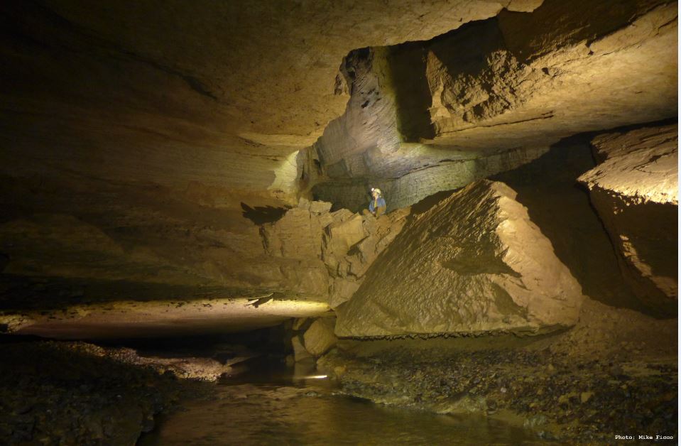
The term karst refers to landscapes created by the dissolving of bedrock. Most karst was formed as carbonate bedrock - limestone, dolomite, or marble - dissolved by mildly acidic waters over thousands of years. Much of this process took place below ground, forming networks of interconnected caves. Not all rocks are soluble. Virginia's Valley and Ridge Province, where most of the state's karst is found, consists mainly of sandstone, shale, limestone, and dolomite, but only the carbonates are soluble, and are exposed on valley floors and along the flanks of some ridges.

water in cave

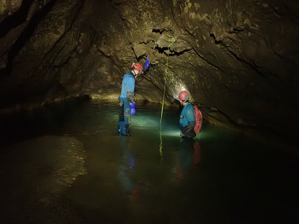
Complex underground drainage networks in karst commonly extend over large areas and beneath surface drainage divides. Precipitation enters these groundwater systems both by infiltration through soils developed over carbonate bedrock and by runoff into features such as sinkholes, sinking and losing streams. Once underground, these 'karst waters' flow through networks of caves, mostly uncharted and inaccessible, and combine to emerge at springs. Karst hydrologists undertake the tricky business of mapping connections between these features to define 'karst watersheds', which typically refer to a particular spring or cave stream.

In karst, surface waters flow quickly underground with little filtration or dilution. Once underground, depending on the local geology, contaminants can travel rapidly over long distances or may be stored in aquifers for long periods of times. In either case, these waters, along with any contaminants, eventually return to the surface through springs and wells and can impact both aquatic life and drinking water. Unless karst hydrologists have studied a karst area, responding to contamination there can be difficult to impossible. Protection of karst requires both the study of karst systems and the conservation of karst features.

powell river spring
Madison Cave isopod, Antrolana lira

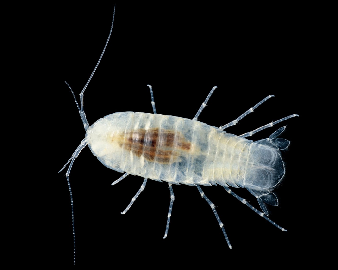
Karst provides and supports habitat for rare animal and plant species, including bats, cave-adapted invertebrates, plants that grow on the surface and at springs and seeps, and fish and mussels living in streams and rivers fed by karst springs. Additionally, many private and public water supplies in Virginia rely on karst groundwater.

Caves in Virginia are protected by the Virginia Cave Protection Act, which prohibits vandalizing caves, formations or artifacts, polluting caves, or disturbing cave organisms.

cave interior
However, few other legally binding mechanisms established for protection of karst features exist in Virginia. Therefore, it is up to property owners to recognize sensitive karst features and help the Natural Heritage Program to preserve and protect them. Identification and protection of sensitive karst areas through appropriate land use planning helps ensure a safe, clean water supply for everyone, while also protecting rare species and natural communities. For the sake of yourself and others, as well as the natural world, please be aware of the karst that surrounds you, and help protect it.

Virginia Department of Conservation and Recreation
600 East Main Street, 24th floor | Richmond, VA 23219-2094 | 804-786-6124
Please send website comments to web@dcr.virginia.gov
Address general inquiries to pcmo@dcr.virginia.gov
Copyright © 2025, All Rights Reserved
Last Modified: Wednesday, 28 May 2025, 02:39:20 PM
eVA Transparency Reports View the Virginia Department of Conservation and Recreation's expenditures.
Contact Us | Media Center | Privacy Policy | ADA Notice | FOIA | Jobs | Code of Ethics (PDF)
DCR Organizational Chart (PDF) | Strategic Plan (PDF) | Executive Progress Report (PDF) | Public Safety & Law Enforcement